
DATE ISSUED: Sunday, August 15, 2021 @ 06:00 LST (10:00 UTC)
VALID UNTIL: Monday morning (06:00 LST) August 16, 2021
...A TROPICAL STORM WARNING IS IN EFFECT FOR ST. MAARTEN…
...SMALL CRAFT AND FLOOD ADVISORIES ARE IN EFFECT UNTIL
FURTHER NOTICE…
WEATHER:
Today: Generally cloudy and breezy with scattered showers and isolated thunderstorms.
Tonight through Monday morning: Partly cloudy and breezy, becoming cloudy at times with isolated showers possible.
Forecast High: 30°C / 86°F Forecast Low: 24°C / 75°F
Sunset Today: 6:38 P.M. Sunrise Tomorrow: 5:55 A.M.
SURFACE WINDS:
Today: East-southeasterly to southeasterly with a gentle to moderate breeze of 10 to 18 mph, with possible higher gusts in and around showers.
Tonight through Monday morning: Southeasterly with a gentle to moderate breeze of 08 to 16 mph.
SYNOPSIS:
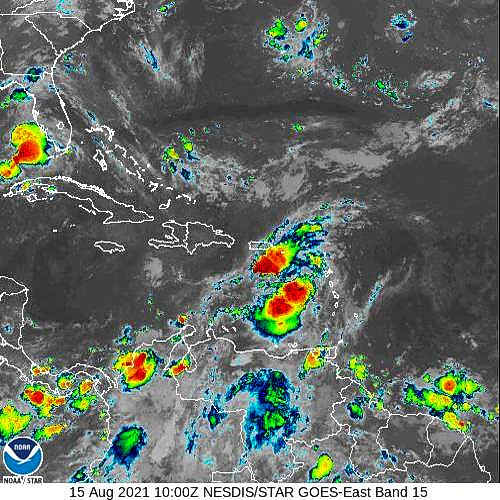
Due to the disorganized nature of Tropical Storm Grace, the potential for scattered showers and isolated thunderstorms remains high and will gradually decrease as the day progresses. These showers could be moderate to heavy in and around thunderstorms. Residents and users of areas prone to flooding and rock-falls should remain vigilant and exercise caution as rainfall accumulation could reach up to 1-2 inches.
Seas are expected to peak at 9 feet. A small craft advisory remains in effect for
St. Maarten. Small craft operators and sea bathers are advised to exercise extreme caution.
STATE OF THE SEA: Moderate to Rough WAVES/SWELLS: 7 to 9 feet
SPECIAL FEATURES:
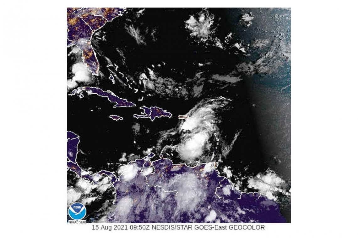
At 5:00 AM, the center of Tropical Storm Grace was located about 120 miles south-southwest of St. Maarten. Grace is moving toward the west near 16 mph
(26 km/h) with maximum sustained winds near 40 mph (65 km/h) and higher gusts. At the closest point of approach, the center of this system passed approximately 100 miles south of St. Maarten early this morning. Some strengthening is likely during the next day or two.
Impacts to St. Maarten are expected to gradually dimmish through today with rainfall up to 2 inches possible, thunderstorms, high seas and high winds.
The Meteorological Department of St. Maarten will continue to monitor the progress of this system and update the public accordingly.
OUTLOOK through Tuesday morning: Partly cloudy and breezy with isolated showers possible.
FORECASTER: Pierre
3-DAY FORECAST
|
DAY |
Sunday |
Monday |
Tuesday |
|
WEATHER |
Generally Cloudy, Breezy, Scattered Showers, Isolated Thunderstorms |
Partly Cloudy, Breezy, Isol. Showers possible |
Partly Cloudy, Breezy, |
|
HIGH TEMP |
30°C / 86°F |
31°C / 88°F |
31°C / 88°F |
|
LOW TEMP |
24°C / 75°F |
27°C / 77°F |
26°C / 79°F |
|
SUNRISE |
05:54 AM |
05:55 AM |
05:55 AM |
|
SUNSET |
06:38 PM |
06:38 PM |
06:37 PM |


