
DATE ISSUED: Monday, August 09, 2021 @ 12:00 LST (16:00 UTC)
VALID UNTIL: Tuesday midday (12:00 LST) August 10, 2021
WEATHER:
This afternoon through tonight: Partly cloudy and breezy with a few brief showers possible.
After midnight through Tuesday midday: Generally cloudy and breezy with scattered showers and isolated thunderstorms.
Forecast High: 32°C / 90°F Forecast Low: 27°C / 81°F
Sunset Today: 6:42 P.M. Sunrise Tomorrow: 5:53 A.M.
SURFACE WINDS:
This afternoon through tonight: East-northeasterly to northeasterly with a gentle to moderate breeze of 10 to 17 mph.
After midnight through Tuesday midday: Easterly to southeasterly with a moderate to fresh breeze of 13 to 20 mph and higher gusts.
SYNOPSIS:
A relatively drier and more stable atmosphere will continue to limit shower activity this afternoon and early tonight ahead of the arrival of Invest 94. With the arrival of Invest 94 later tonight, expect cloudy skies, gusty winds, scattered showers and isolated thunderstorms which could lead to heavy showers. Motorists and persons living in low lying areas should be vigilant for localized flooding and rock falls.
Seas are expected to peak at 9 feet with the arrival of Invest 94. Small craft operators and sea bathers should exercise caution. A small craft advisory will go into effect as of tonight.
STATE OF THE SEA: Moderate WAVES/SWELLS: 5 to 7 feet
SPECIAL FEATURES:
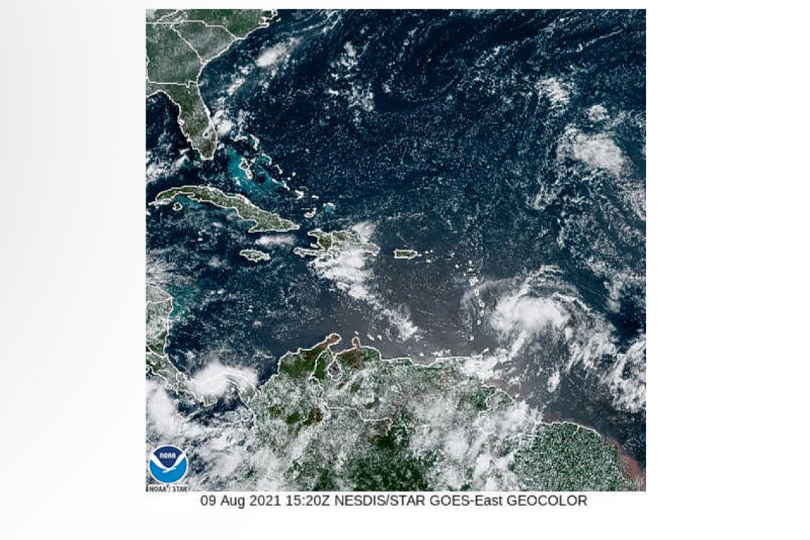
1. Showers and thunderstorms associated with Invest 94 located about 510 miles SSE of St. Maarten have become more concentrated. Heavy rainfall, thunderstorms and gusty winds are likely over the local area late tonight into Tuesday. If needed, watches and/or warnings could be required with very short notice based on further development and track of this system.
Residents of St. Maarten are encouraged to remain vigilant and monitor updates from the Meteorological Department.
2. Disorganized showers and thunderstorms have changed little in association with an elongated low pressure area located about 1000 miles east of the Lesser Antilles. Development of this system is becoming less likely during the next few days while it moves toward the west or west-southwest at around 10 mph.
The Meteorological Department of St. Maarten will continue to monitor these systems and update the public accordingly.
OUTLOOK through Wednesday midday: Partly cloudy to cloudy and breezy with isolated showers and isolated thunderstorms possible.
FORECASTER: Pierre.


