
....INTERESTS IN THE NORTHERN LEEWARD ISLANDS SHOULD MONITOR THE PROGRESS OF PHILIPPE...
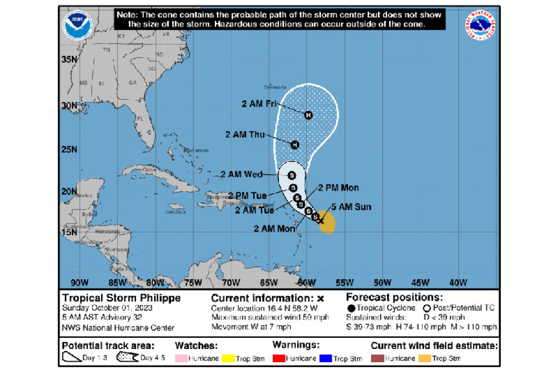
Tropical Storm Philippe Advisory Number 32
NWS National Hurricane Center Miami FL AL172023
500 AM AST Sun Oct 01 2023
SUMMARY OF 500 AM AST...0900 UTC...INFORMATION
----------------------------------------------
LOCATION...16.4N 58.2W
ABOUT 210 MI...340 KM E OF GUADELOUPE
ABOUT 250 MI...405 KM ESE OF BARBUDA
MAXIMUM SUSTAINED WINDS...50 MPH...85 KM/H
PRESENT MOVEMENT...W OR 280 DEGREES AT 7 MPH...11 KM/H
MINIMUM CENTRAL PRESSURE...999 MB...29.50 INCHES
WATCHES AND WARNINGS
--------------------
There are no coastal watches or warnings in effect.
Interests in the northern Leeward Islands should monitor the progress of this system. Tropical storm watches or warnings may be required for a portion of that area later today.
DISCUSSION AND OUTLOOK
----------------------
At 500 AM AST (0900 UTC), the center of Tropical Storm Philippe was located near latitude 16.4 North, longitude 58.2 West. Philippe ismoving toward the west near 7 mph (11 km/h). A west-northwestward to northwestward motion is expected to begin today and continue into tonight. A turn toward the northwest with an increase in forward speed is expected Monday, followed by a northward motion on Tuesday. On the forecast track, the center of Philippe is forecast to pass near or just northeast of the northern Leeward Islands on Monday and Monday night.
The Meteorological Department of St. Maarten (MDS) put the cyclone at approximately 345 miles east-southeast. It said some uncertainty remains about both track and intensity of Philippe.
Maximum sustained winds are near 50 mph (85 km/h) with higher gusts. Little change in strength is expected during the next day or so. Some strengthening is possible by late Monday as Philippe begins to move north of the Leeward Islands.
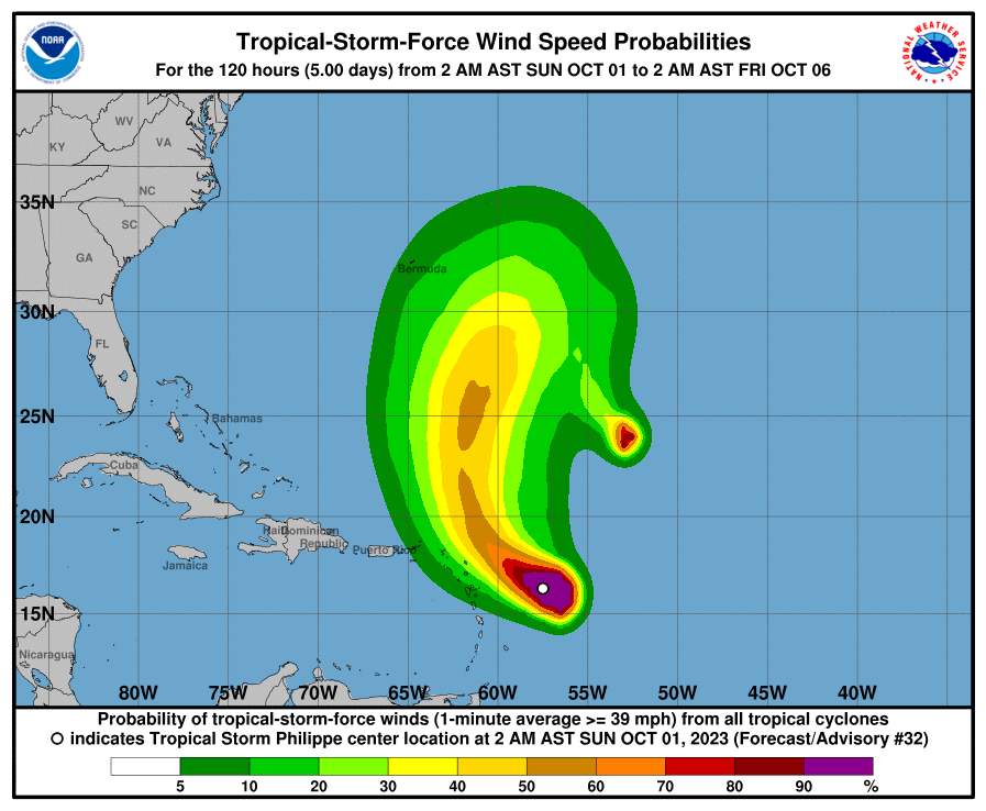
Tropical-storm-force winds extend outward up to 150 miles (240 km) primarily to the east of the center.
The estimated minimum central pressure is 999 mb (29.50 inches).
HAZARDS AFFECTING LAND
----------------------
RAINFALL: Philippe is forecast to produce 1 to 4 inches of rain across portions of the Leeward Islands by Monday into Tuesday. This rainfall may result in isolated flash flooding.
WIND: Gusty winds are possible in portions of the northern leeward islands by Monday.
SURF: Swells generated by Philippe will affect portions of the Atlantic coasts of the northern Leeward Islands, the Virgin Islands, and Puerto Rico during the next few days. These swells are likely to cause life-threatening surf and rip current conditions.
Forecaster Brown


