ERIN 180 MILES NORTHEAST
WINDS 120mph
SPECIAL WEATHER BULLETIN # 7
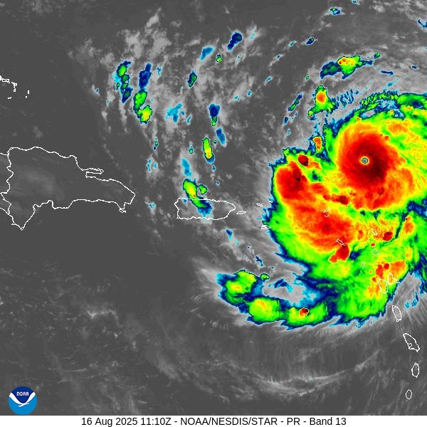
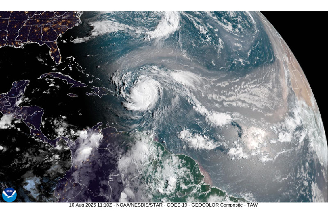
At 5:00am, the center of Hurricane Erin was located near latitude 19.8 North, longitude 61.1 West or about 180 miles northeast of St. Maarten. The system is moving toward the west-northwest near 20 mph (31 km/h). This motion is expected to continue through the weekend with a gradual decrease in forward speed.
On the forecast track, the center of Erin is likely to pass approximately 145 miles north-northeast of St. Maarten later this morning.
Maximum sustained winds are up to 120 mph (195 km/h) with higher gusts. Continued rapid strengthening is expected, and Erin could become a Category 4 Hurricane later today.
Hurricane-force winds extend up to 30 miles (45 km) from the center. Tropical-storm-force winds extend up to 125 miles (205 km) from the center.
The estimated minimum central pressure is 955 mb (28.20 inches).
HAZARDS AFFECTING LAND:
- RAINFALL: The outer bands of Erin could produce rainfall accumulation of up to 2 to 4 inches (possibly up to 6 inches in some areas). This could be accompanied by thunderstorms, which would likely cause street-flooding and/or rock-falls. Hence, a
Flood Advisory is in effect!
- Winds: Strong breezes, with gusts up to 40-50 mph could be expected on St. Maarten.
- Seas: Rough seas (up to 9 feet), mainly along the northern and eastern shores with ground swells are expected. Interests along the coast should take the necessary actions to preserve life and property.
A Small Craft Advisory is in effect until further notice, which may be upgraded to a Small Craft Warning later today.
The public is urged to remain alert and monitor subsequent updates from the Meteorological Department and Disaster Management.