





NWS National Hurricane Center Miami FL
700 AM EST Thu Nov 19 2026
For the North Atlantic...Caribbean Sea and the Gulf of America:
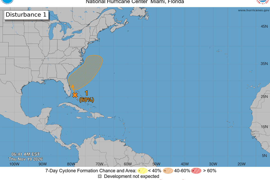
Offshore of the Southeast U.S. Coast:
 Disorganized showers and thunderstorms near the northwestern Bahamas
and Florida are associated with a frontal system. A non-tropical low pressure system is expected to form along the front near the northwest Bahamas on Friday. This system could become a subtropi-cal or tropical storm while it moves northward or northeastward near or just offshore of the south-eastern U.S. coast through the weekend. Regardless of development, strong winds, dangerous surf, and coastal flooding are likely along portions of the southeast and mid-Atlantic coasts into early next week. Interests along the eastern U.S. coast should monitor the progress of this system. For more information on this system, including Gale Warnings, please see High Seas Forecasts issued by the Na-tional Weather Service.
* Formation chance through 48 hours...low...20 percent.
* Formation chance through 7 days...medium...60 percent.
Forecaster Hagen