





NWS National Hurricane Center Miami FL
800 AM EDT Mon Aug 10 2026
For the North Atlantic...Caribbean Sea and the Gulf of America:
Eastern and Central Tropical Atlantic:
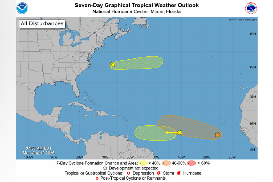
An area of low pressure located a few hundred miles south of the Cabo Verde Islands is producing disorganized showers and thunderstorms. As this system moves slowly westward, a tropical wave currently over west Africa is expected to merge with it in a couple of days. Environmental conditions are forecast to be more conducive for development by midweek, and a tropical depression could form during the latter half of this week while the system moves westward
to west-northwestward across the central tropical Atlantic.
* Formation chance through 48 hours...low...20 percent.
* Formation chance through 7 days...medium...60 percent.
Central Tropical Atlantic: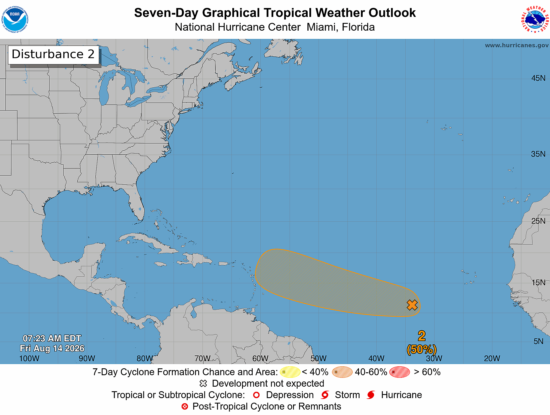
A broad area of showers and thunderstorms associated with a tropical wave is located about midway between the coast of west Africa and the Lesser Antilles. Some gradual development of this system is possible through mid-week while it moves quickly westward across the central tropical Atlantic. Up-per-level winds are expected to become less favorable for development later in the week as the sys-tem approaches the Lesser Antilles.
* Formation chance through 48 hours...low...10 percent.
* Formation chance through 7 days...low...10 percent.
Western Subtropical Atlantic:
A trough of low pressure located a few hundred miles northwest of Bermuda is producing disor-ganized shower and thunderstorm activity. Some development of this system is possible during the next couple of days while it moves quickly eastward, well to the north of Bermuda, across the western and central subtropical Atlantic. The system is forecast to reach cooler waters later this week, ending its chances of formation after Wednesday.
* Formation chance through 48 hours...low...10 percent.
* Formation chance through 7 days...low...10 percent.
Forecaster Adams/Pasch