
NWS National Hurricane Center Miami FL
840 AM EST Thu Dec 8 2022
For the North Atlantic...Caribbean Sea and the Gulf of Mexico:
Special Tropical Weather Outlook issued to discuss the potential for subtropical development over the central Atlantic.
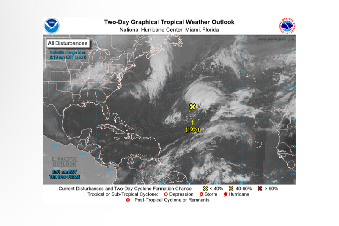
1. Central Subtropical Atlantic:
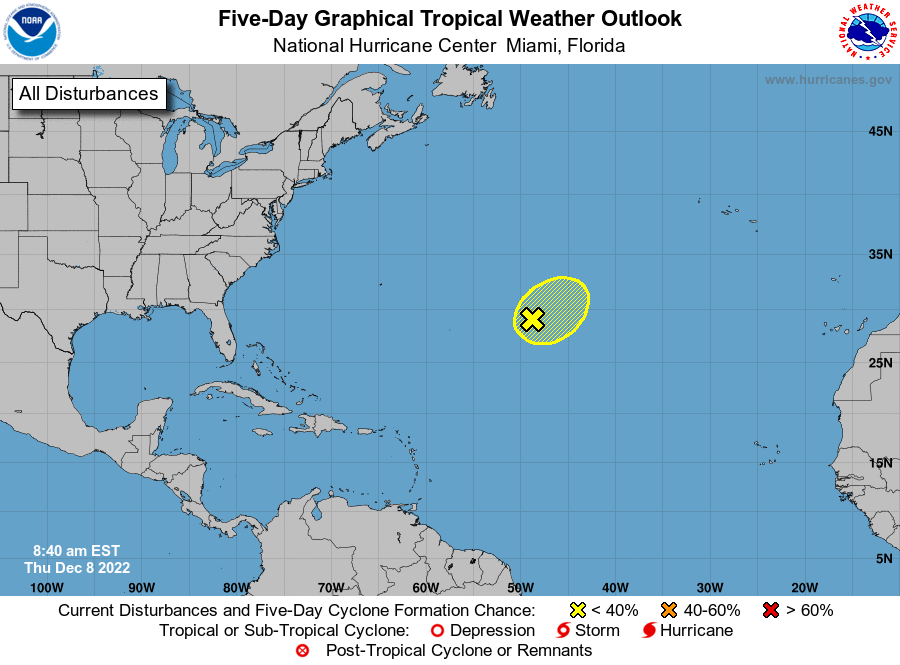 A non-tropical low pressure area located about 925 miles east-southeast of Bermuda continues to produce an extensive area of showers and thunderstorms. However, the system remains embedded within a frontal zone, which is expected to become even more pronounced later today as the low begins to move east-northeastward at 20 to 25 mph toward colder waters and interacts with a mid-latitude trough. Therefore, it is unlikely that the low will transition to a subtropical or tropical cyclone. Nevertheless, significant non-tropical development of this low is expected during the next couple of days, and additional information, including hurricane-force wind warnings, can be found in High Seas Forecasts issued by the National Weather Service.
This will be the last Special Tropical Weather Outlook issued on this system. Regularly scheduled Tropical Weather Outlooks will resume on May 15, 2023, while Special Tropical Weather Outlooks will be issued as necessary during the off-season.
* Formation chance through 48 hours...low...10 percent.
* Formation chance through 5 days...low...10 percent.
Forecaster Brown


