
A drone being checked.
ST. JOHNS, Antigua--Ecosystem-based Adaptation (EbA) is a strategy for adapting to climate change that harnesses nature-based solutions and ecosystem services. Vetiver grass and the Vetiver System (VS) is a nature-based solution. This serves as a tool to stabilise land, reduce erosion, slow down run-off and recharge groundwater – thus working with both people and environment, as it helps to protect infrastructure and property, regenerate topsoil and reduce sedimentation affecting downstream river and marine environments in coastal areas.
The Vetiver Education and Empowerment Project (VEEP) models as an EbA approach to take knowledge, education and training to communities about Vetiver grass and the VS as a low-cost green infrastructure tool to solve a wide range of soil and water related challenges across Antigua and Barbuda, Dominica, St. Lucia and Trinidad and Tobago.
In Antigua, the Vetiver grass has been planted at two locations, the Cooks Land Fill and Gilbert Agricultural and Rural Development Center (GARDC).
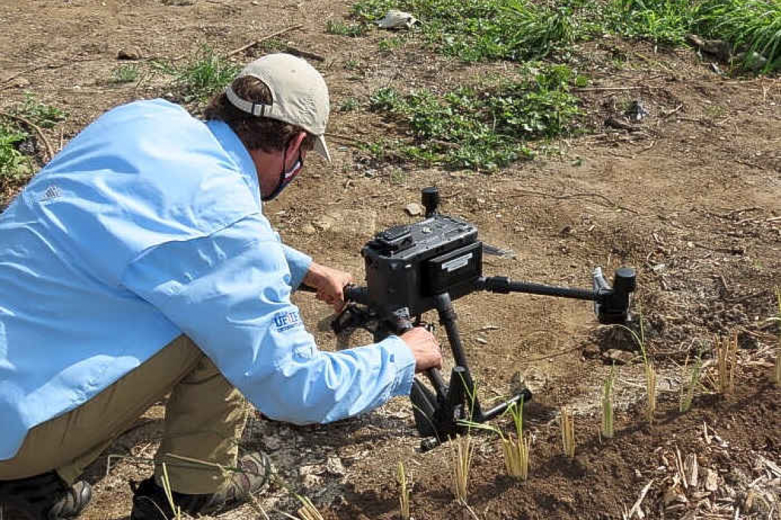
A component of the project at the Cooks Landfill included “geomapping” of the area using drone technology, which was done by Eben Broadbent, a professor at the University of Florida who co-directs the special ecology and conversation lab at the university.
Broadbent has been involved in the project from the beginning as it pertains to environmental monitoring and the socio-economic component with focus on biology, ecology and remote sensing.
A key component of the remote sensing is the use of drone technology where it uses high-resolution cameras like other cameras and uses a light sensor camera that shoots hundreds of thousands of lasers per second. This feature on the drone allows for development of a very detailed topographic map of the area.
Broadbent explained that in a year he would return using the same system to collect additional data, which will enable them to get an understanding of erosion rates, changes, growth of the landfill and how things might be changing in the natural environment.
Different countries have different case studies depending on the natural topography and land cover of the region. In Dominica, they are focused on communities and the very steep topography, and in Antigua it is focused on a landfill.
Broadbent pointed out, “unique issues with this landfill are; though not naturally created it does have problems with erosion and runoff which can have very high quantities of contaminated material obviously because it is a giant human-made mountain of trash. To limit contamination of the landfill through surface water flow and groundwater flow to the surrounding bays and natural ecosystems, the concept here is to have multiple rows of vetiver which will allow for noticeable positive reduction in surface groundwater flow and reducing erosion rates.”
Through the initial scouting with drone photography, it was revealed that there were very fast rates of erosion in the surrounding landfill. This is expected because it is a newly created surface with a mixture of dirt and trash, so any amount of rainfall particularly in areas that are subject to climate change and fast high volumes of precipitation will result in erosion. ~ Antigua News Room ~


