
Storm wind speed probabilities
~ Erin forecast to become hurricane today ~
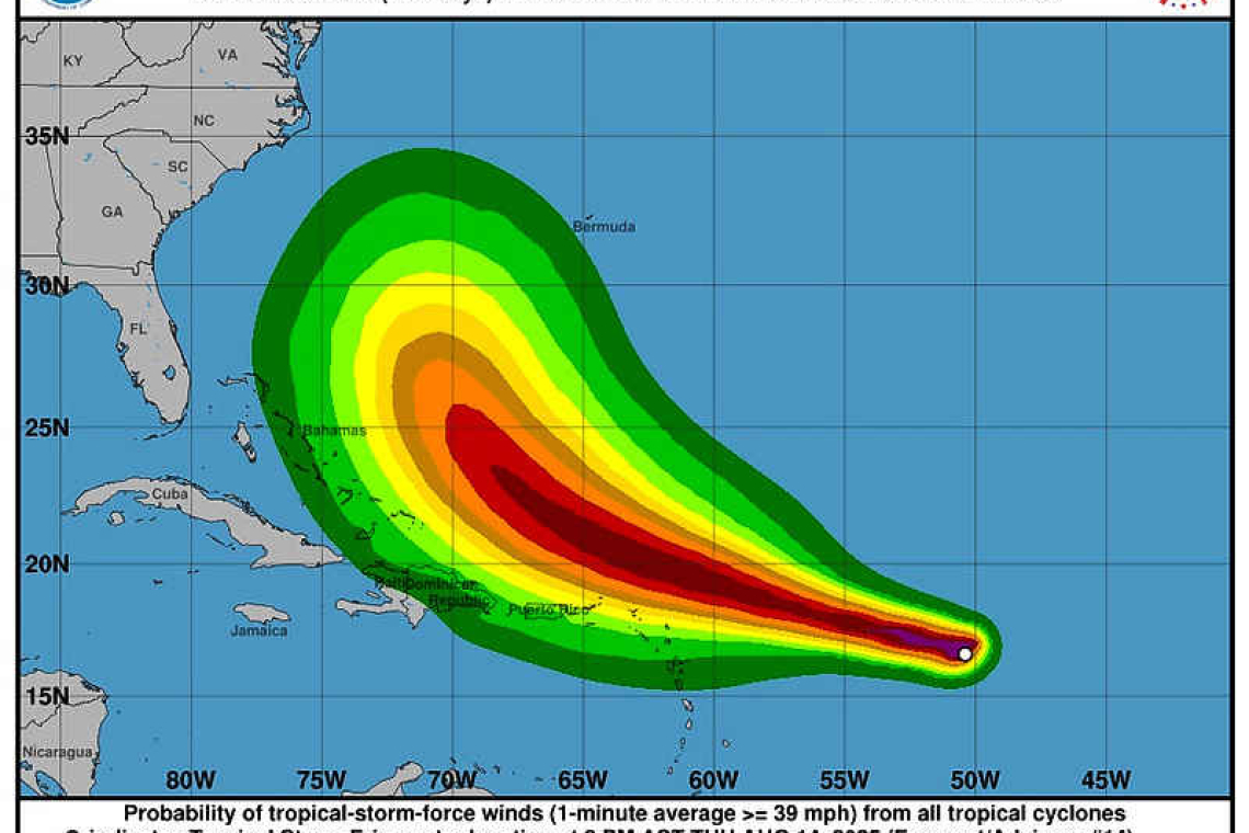
PHILIPSBURG--The centre of Tropical Storm Erin was located at 5:00pm Thursday near latitude 16.7 North, longitude 51.2 West or about 790 miles (1,270 kilometres) east of the Northeast Caribbean. Erin had been moving toward the west at 280 degrees near 17mph (28km/h). A turn toward the west-northwest was expected overnight, with this motion to continue into the weekend.
According to the US National Hurricane Center (NHC) in Miami, on its forecast track the centre of Erin is likely to move near or just north of the northern islands over the weekend.
In its first special weather bulletin on the storm, the Meteorological Department of St. Maarten (MDS) Thursday evening put the cyclone at 792 miles east-southeast. It said the centre of Erin’s closest point is expected to be approximately 135 miles northeast of the island on Saturday.
NHC in its 8:00pm intermediate advisory reported maximum sustained winds were up to 70mph (110km/h) with higher gusts and further strengthening expected. NOAA aircraft data indicated Erin was already nearing hurricane strength.
Tropical-storm-force winds extended up to 60 miles (95 km) from the centre. The estimated minimum central pressure was 999 millibars (29.50 inches).
The system could produce rain accumulation of up to 2-4 inches (with isolated totals of 6 inches) over the region. This rainfall may be accompanied by thunderstorms and could produce flash flooding and rock falls. A flood advisory/warning will be issued if necessary.
Tropical storm force winds are likely to begin on St. Maarten early Saturday.
Sea conditions will gradually deteriorate. Small craft advisories and watches will
be issued as conditions warrant.
- Residents in areas prone to flooding or near the coast should make the necessary preparations to protect life and property.
- The public should remain alert, continue preparations, and monitor the updates from the Meteorological Department and Disaster Management.
The Meteorological Department of St. Maarten will continue to monitor the progress of this system and keep the public updated accordingly.
A Special Weather Bulletin is issued for weather events that are unusual, cause general inconvenience or public concern (requiring the attention and action of emergency authorities) and cannot adequately be described in a regular weather forecast.
A Small Craft Advisory announces that the sea will likely become rough today or is already occurring.
A Flash Flood Alert/Advisory announces that heavy rainfall will occur today or is already occurring.
A Tropical Storm is a cyclone with sustained winds between 34-63 knots (39-73 mph).
A Tropical Storm Watch means that tropical storm conditions are possible somewhere within the warning area within 48 hours.
The Meteorological Service of Antigua/Barbuda has issued a Tropical Storm Watch for Anguilla and Barbuda.
The Meteorological Service of France has issued a Tropical Storm Watch for St. Martin and St. Barthelemy.
The Meteorological Service of the Netherlands has issued a Tropical Storm Watch for Saba and St. Eustatius.
Tropical Storm Watches were in effect for:
* Anguilla and Barbuda
* St. Martin and St. Barthelemy
* Saba and St. Eustatius
* St. Maarten
Interests in the Virgin Islands and Puerto Rico were also advised to monitor Erin’s progress.


