





DATE ISSUED: Saturday 29th August 2026 @ 12:00 LST (16:00 UTC)
VALID UNTIL: Sunday midday (12:00 LST) 30th August 2026
… A FLOOD ADVISORY WILL BE IN EFFECT FROM 7PM TONIGHT FOR THE NEXT 24 HOURS …
WEATHER:
Today: Occasionally cloudy and slightly breezy with isolated showers likely.
Tonight through Sunday midday: Generally cloudy and breezy with scattered showers and isolated thunderstorms.
Forecast High: 33°C / 91°F Forecast Low: 24°C / 75°F
Sunset Today: 6:29 P.M. Sunrise Tomorrow: 5:58 A.M.
SURFACE WINDS:
This afternoon through Sunday midday: Northeasterly to southeasterly with a gentle to fresh breeze at 10 to 20 mph; higher gusts are likely during showers.
SYNOPSIS:
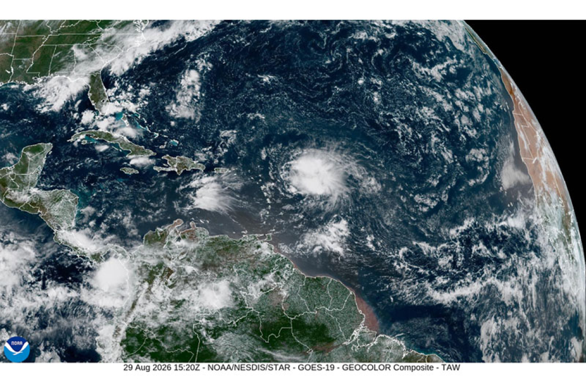
An approaching tropical wave (remnants of Dolly) will cause cloudiness, heavy showers and thunderstorms. Residents and users of areas prone to flooding and rockslides are advised to be vigilant and exercise caution. Meanwhile, breezy conditions will prevail.
Smooth to moderate sea conditions will prevail.
|
SEA CONDITIONS: |
STATE: |
WAVES/SWELLS: |
|
Sheltered Areas |
Smooth to slight |
Up to 3ft |
|
Open Waters |
Slight to moderate |
3 – 6ft |
SPECIAL FEATURE: None
OUTLOOK through Monday midday: Cloudy and breezy with scattered showers and isolated thunderstorms.
3-DAY FORECAST:
|
DAY |
Saturday |
Sunday |
Monday |
|
WEATHER |
Partly Cloudy / Cloudy Scattered Showers |
Cloudy & Breezy Widespread Showers Isolated Thunderstorms |
Cloudy Scattered Showers Isolated Thunderstorms |
|
HIGH TEMP |
33°C / 91°F |
29°C / 84°F |
31°C / 88°F |
|
LOW TEMP |
27°C / 81°F |
24°C / 75°F |
24°C / 75°F |
|
SUNRISE |
05:58 AM |
05:58 AM |
05:58 AM |
|
SUNSET |
06:29 PM |
06:28 PM |
06:27 PM |