
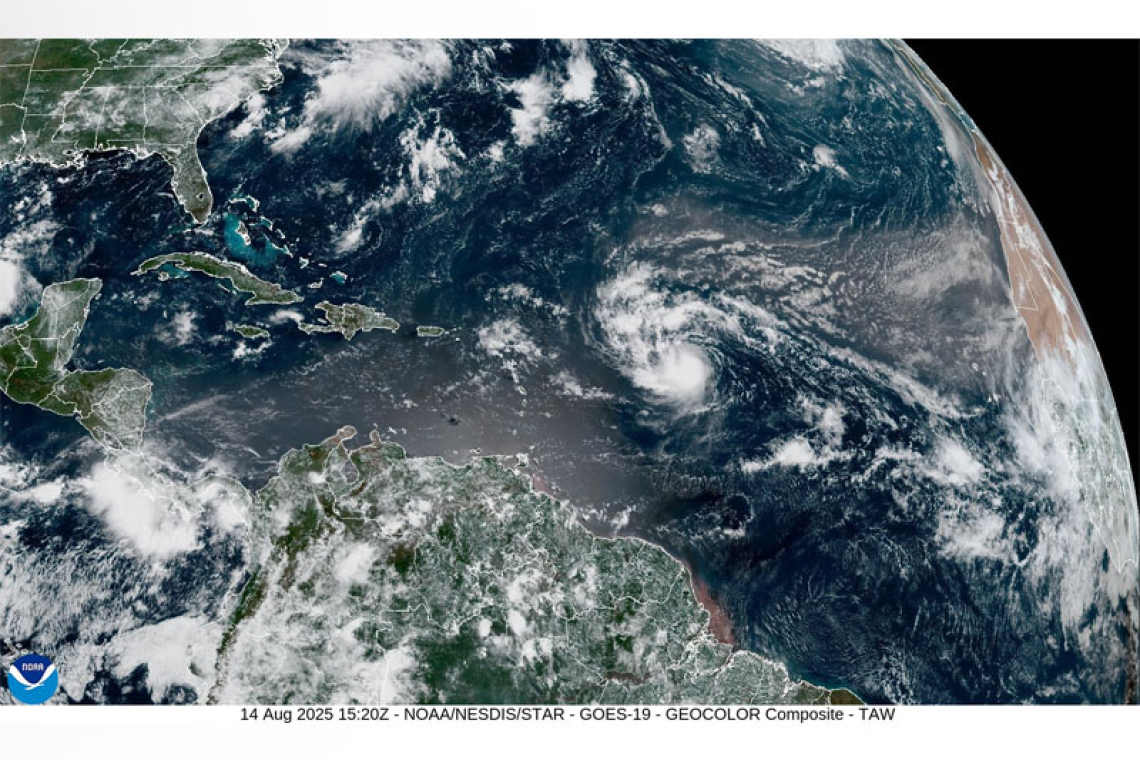
The Meteorological Department of St. Maarten (MDS) continues to closely monitor Tropical Storm Erin, located this morning near 16.4° N, 49.7° W or about 890 miles East southeast of St. Maarten.
Erin is moving west at 17 mph (15 knots).
Maximum sustained winds have increased to near 60 mph with higher gusts.
Forecast models are indicating a more west northwesterly turn later tonight which could bring the center of Erin about 145miles North northeast at its closest to St. Maarten some time on Saturday August 16th 2025.
Tropical Storm Erin is also forecast to move to an area of warmer waters which could result in a peri-od of rapid intensification. This means that Erin could potentially become a major hurricane by the weekend.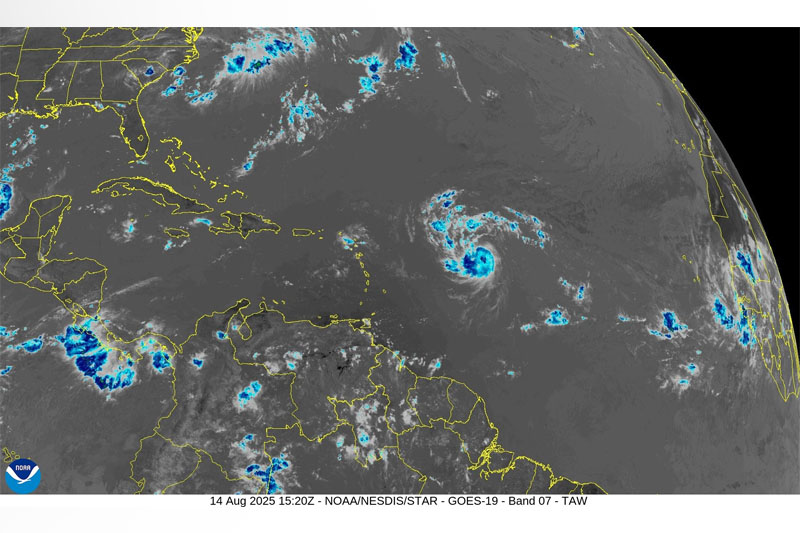
Due to the uncertainties surrounding both track and intensity of this system it may become necessary to issue a Watch for St. Maarten later today or tonight. Therefore the public is advised to make all necessary preparations to protect life and property, remain alert and continue to monitor the pro-gress of Tropical Storm Erin through all official mediums.
Potential impacts associated with this system are heavy rainfall and thunderstorms, gusty winds and elevated seas.
The Meteorological Department of St. Maarten (MDS) continues to monitor the development of this system and urges the public to be on the alert for subsequent updates as conditions could change at short notice. Please stay tuned to subsequent updates for specifics on related impacts


