
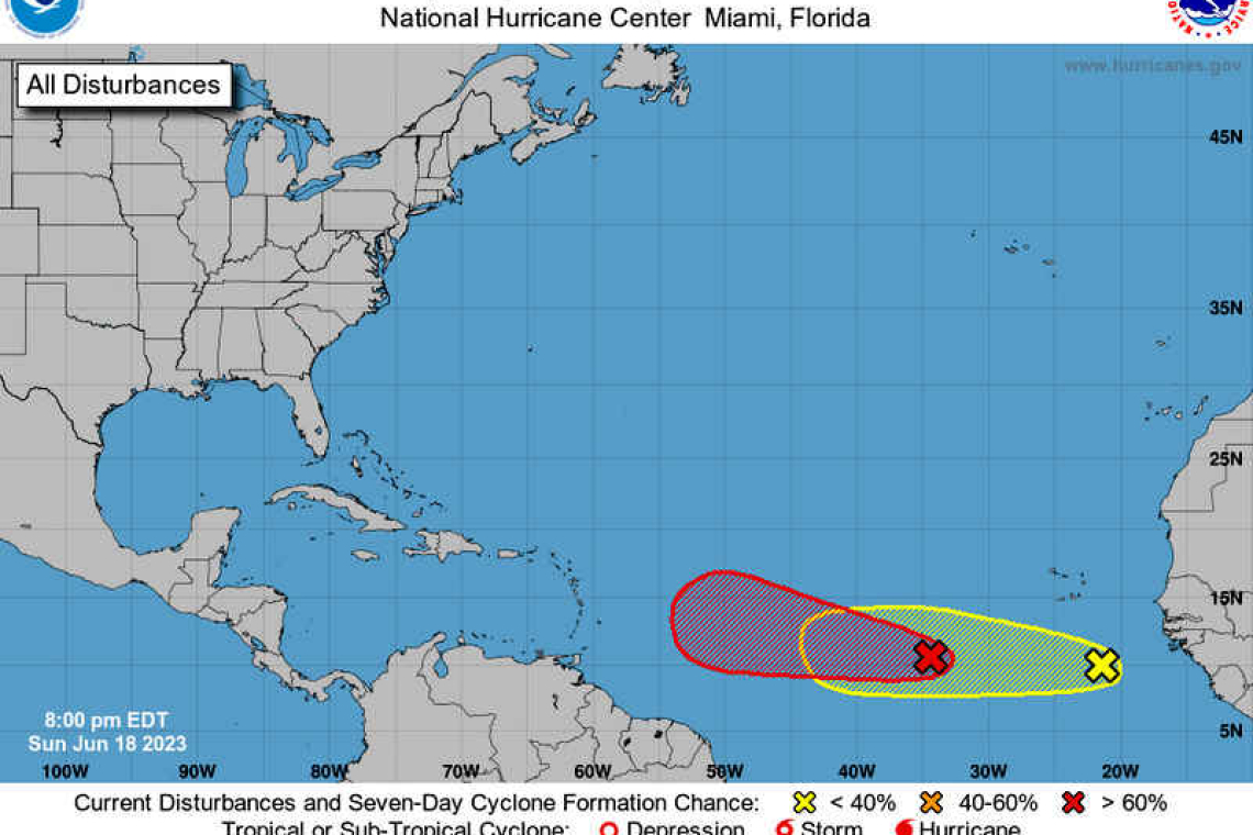
Showers and thunderstorms continued to become better organised Sunday evening in association with a broad area of low pressure located several hundred miles south-west of the Cabo Verde Islands. Environmental conditions appeared conducive for additional development, and a tropical depression or storm was expected to form over the next day or so.
This system is forecast to move westward at 15 to 20 miles per hour (mph) across the central tropical Atlantic with further development through the middle part of the week. The cyclone formation chance was high (90%) through both 48 hours and seven days. Meanwhile, another area of showers and thunderstorms a few hundred miles south of the Cabo Verde Islands was associated with a tropical wave that recently emerged off the coast of Africa. While this activity was still disorganised, some slow development of this system is possible through the middle to latter part of this week as the system moves westward at about 15mph across the eastern and central tropical Atlantic. The cyclone formation was low through both 48 hours (10%) and seven days (20%).


