NWS National Hurricane Center Miami FL
700 AM EST Thu Nov 19 2020
For the North Atlantic...Caribbean Sea and the Gulf of Mexico:
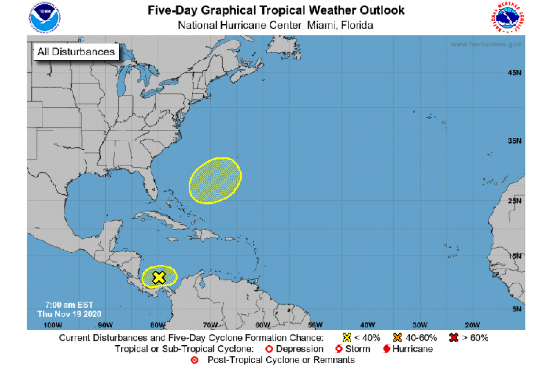
1. An area of disorganized showers and thunderstorms located over the far southwestern Caribbean Sea just off the northern coast of Panama is associated with a broad area of low pressure. Development of this system, if any, is expected to be slow to occur while it drifts westward across the southwestern Caribbean Sea during the next several days. Regardless of tropical cyclone formation, areas of heavy rain are possible during the next several days across portions of Central America from Nicaragua southward to Colombia, potentially causing additional flooding in previously inundated areas.
* Formation chance through 48 hours...low...near 0 percent.
* Formation chance through 5 days...low...10 percent.
2. A non-tropical area of low pressure could form between the Bahamas and Bermuda by early next week. The system could gradually develop subtropical characteristics through the middle of next week while it moves northeastward over the western Atlantic.
* Formation chance through 48 hours...low...near 0 percent.
* Formation chance through 5 days...low...20 percent.