
NWS National Hurricane Center Miami FL
800 AM EDT Tue Sep 16 2025
For the North Atlantic...Caribbean Sea and the Gulf of America:
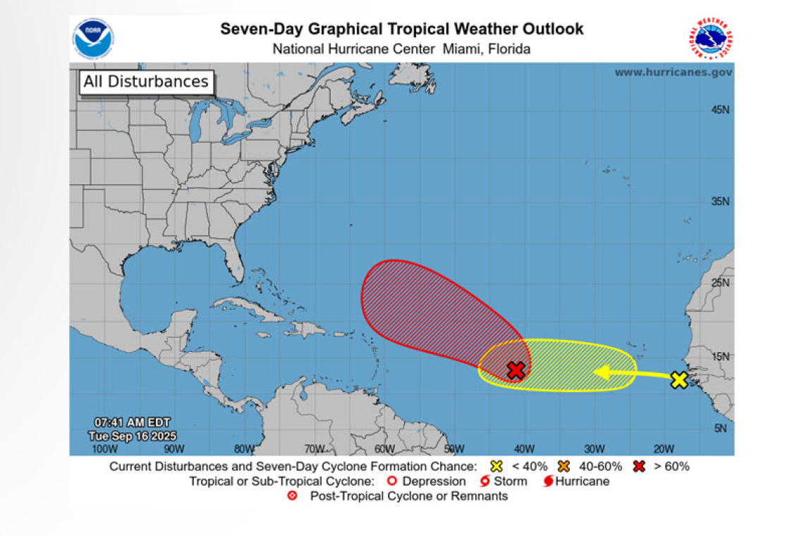
1. Central Tropical Atlantic (AL92):
 Showers and thunderstorms associated with a broad low pressure area located about midway be-tween the Windward Islands and the coast of west Africa have become better organized since yes-terday. Environmental conditions are conducive for additional development, and a tropical depression or storm is likely to form in the next day or two as the system moves west-northwestward or north-westward at 10 to 15 mph over the central tropical Atlantic.
* Formation chance through 48 hours...high...90 percent.
* Formation chance through 7 days...high...90 percent.
2. Eastern Tropical Atlantic:
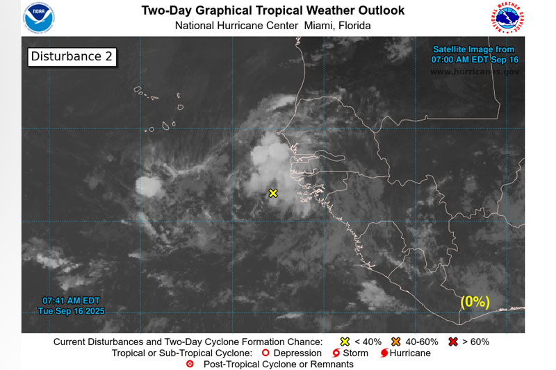 A tropical wave emerging off the west coast of Africa is producing an area of disorganized showers and thunderstorms. Some slow development of this system is possible towards the mid to latter part of this week as it moves westward at 15 to 20 mph, moving from the eastern to central portion of the tropical Atlantic.
* Formation chance through 48 hours...low...near 0 percent.
* Formation chance through 7 days...low...20 percent.
Forecaster Beven


