
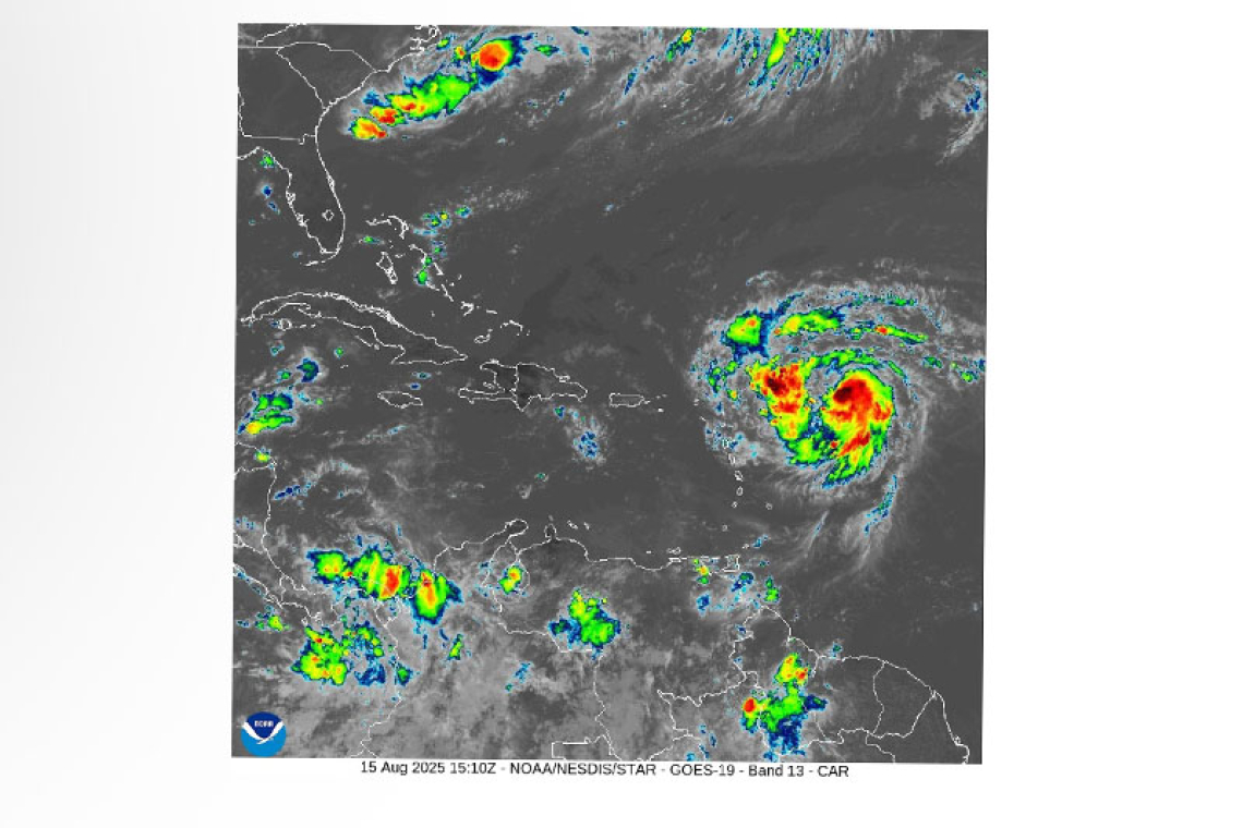
At 11:00 am the center of Hurricane Erin was located near latitude 18.2 North, longitude 56.1 West or about 460 miles east of St. Maarten. The system is moving toward the west northwest near 18 mph (30 km/h). This motion expected to continue into the weekend.
On the forecast track, the center of Erin is likely to move near or just north of the northern Leeward Islands over the weekend. Its closest point is expected to be approximately 150 miles north of St. Maarten sometime on Saturday.
Maximum sustained winds are near 75 mph (120 km/h) with higher gusts. Steady to rapid Strength-ening is forecast during the next two to three days, and Erin is expected to become a major hurricane this weekend.
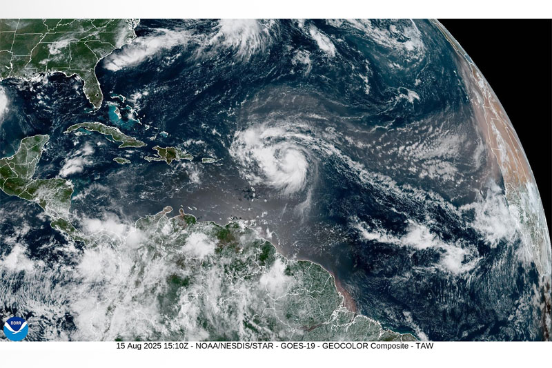
Hurricane-force winds extend up to 25 miles (35 km) from the center. Tropical-storm-force winds ex-tend up to 115 miles (185 km) mainly to the north of the center. The estimated minimum central pressure is 996 mb (29.42 inches).
HAZARDS AFFECTING LAND:
RAINFALL: This system could produce rain accumulation of up to 2 to 4 inches (with isolated totals of 6 inches) over the region. This rainfall may be accompanied by thunderstorms and could produce flash flooding and rock falls. Flood Advisory/warning will be issued if necessary.
WIND: Tropical storm force winds are likely to begin on St. Maarten early Saturday.
SEAS: Sea conditions will gradually deteriorate. Small craft advisories and watches will be issued as conditions warrant.
• Residents in areas prone to flooding or near the coast should make the necessary preparations to protect life and property.
• The public should remain alert, continue preparations, and monitor the updates from the Meteoro-logical Department and Disaster Management.
The Meteorological Department of St. Maarten will continue to monitor the progress of this system and keep the public updated accordingly.
FORECASTER: Albert/ enderson
A Special Weather Bulletin is issued for weather events that are unusual, cause general inconvenience or public concern (requiring the attention and action of emergency authorities) and cannot ade-quately be described in a regular weather forecast.
A Small Craft Advisory announces that the sea will likely become rough today or is already occurring.
A Flash Flood Alert/Advisory announces that heavy rainfall will occur today or is already occurring.
Tropical Storm a cyclone with sustained winds between 34-63 knots (39-73 mph).
A Tropical Storm Watch means that tropical storm conditions are possible somewhere within the warning area within 48 hours.


